

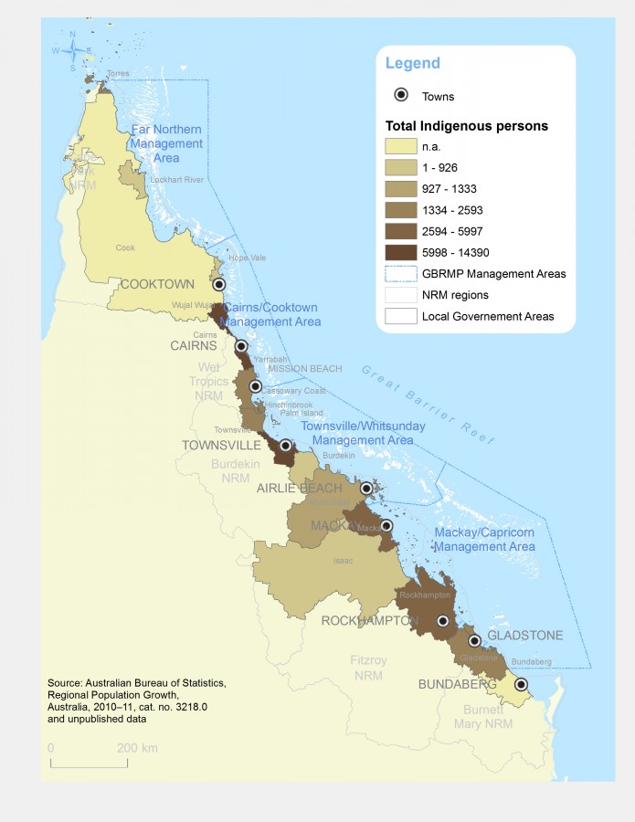
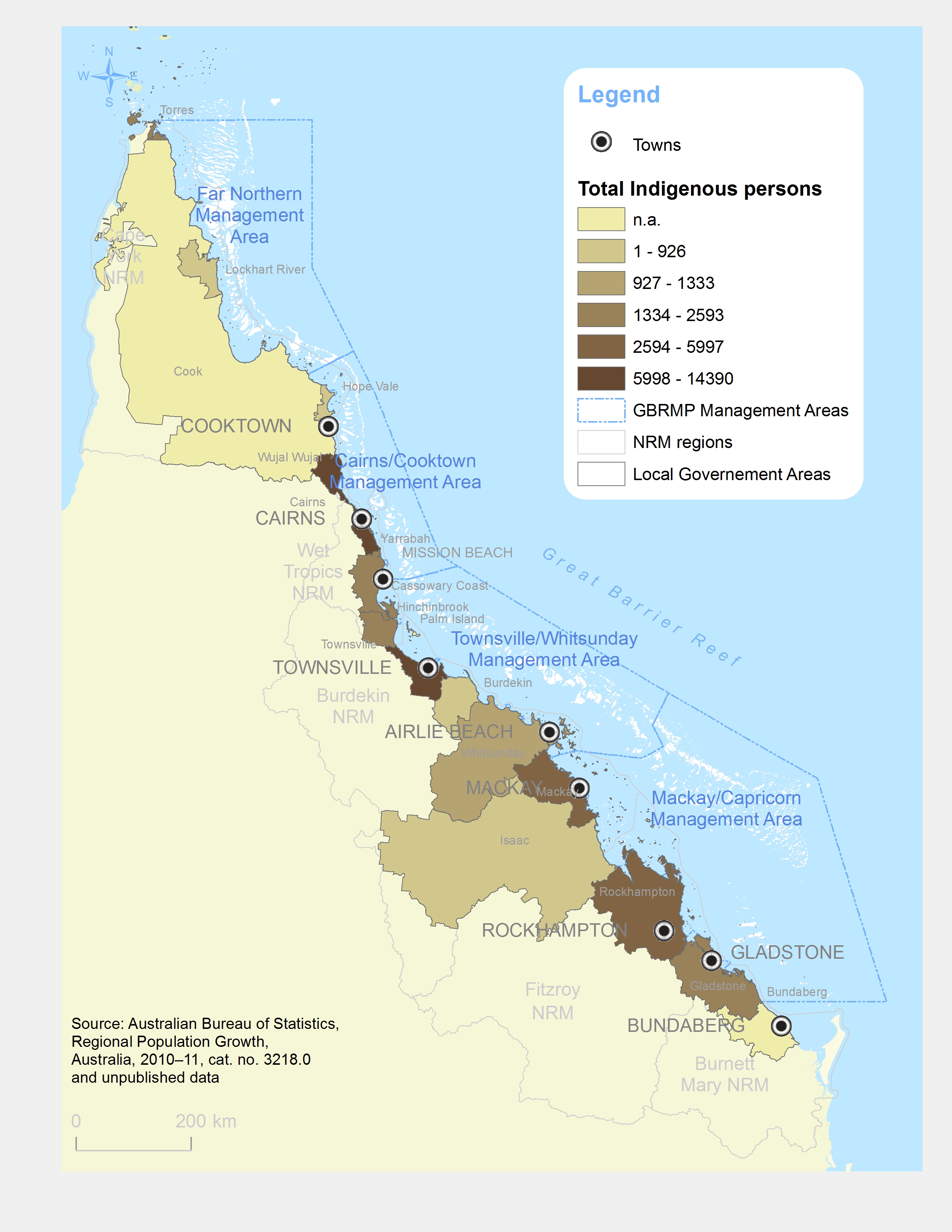
Distribution map of Qld indigenous persons (in nb. of persons)
Photographers: Petina Pert
Description
Distribution map of indigenous persons in Queensland, aggregated by Local Government Areas (LGA) regions.
Source: Australian Bureau of Statistics, Regional Population Growth, Australia, 2010-11, cat. No. 3218.0 and unpublished data
Image produced for the project