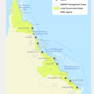
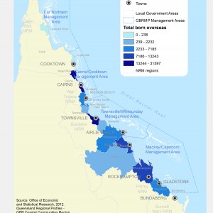
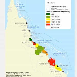
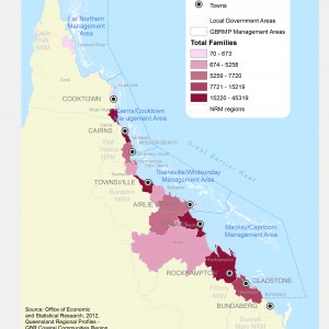
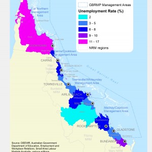
Main menu

  • eAtlas
  • Regions / Sites
    • All regions - eAtlas
    • Torres Strait eAtlas
    • North West Atlas
    • SELTMP site
    • Wet Tropics Vegetation Interactive Maps
    • eReefs visualisation

Search form

SELTMP starfish

Social and Economic Long-Term Monitoring Program

branding-menu-SELTMP

  • Home
  • People and the GBR
    • Commercial Fishers
    • Recreational Users
    • Tourists and Tourism Operators
    • Coastal Communities
    • Catchment Industries
    • Ports and Shipping
    • National Residents
    • Well Being
    • Drivers of Change
  • Maps and Data
    • Interactive Map
    • Map Gallery - 2011
    • Map Gallery - 2012
    • Map Gallery - 2013
    • Map Gallery - 2014
    • Survey Data
  • About SELTMP
  • RSS Feed
SELTMP starfish

Social and Economic Long-Term Monitoring Program

Map Gallery - 2012

18 Local Government Areas (LGAs) of the GBR region (2012)

CC BY NC
GBR Coastal Communities Number of Indigenous Residents by LGA 2012 (ABS data)

CC BY NC
GBR Coastal Communities Percent of Population with Internet Connection by LGA 2012

CC BY NC
GBR Coastal Communities Population Density by LGA 2012

CC BY NC
GBR Coastal Communities Residents Born Overseas by LGA 2012

CC BY NC
GBR Coastal Communities Total Domestic Waste by Weight by LGA 2012

CC BY NC
GBR Coastal Communities Total Families by LGA 2012 (ABS data)

CC BY NC
GBR Coastal Communities Unemployment Rate by LGA

CC BY NC
GBRMP Special Management Areas for Public Appreciation 2012

CC BY NC
LGAs Represented in GBRMPA Reef Guardians Council 2012

CC BY NC
Median House Prices by LGA 2012 (ABS data)

CC BY NC
Pilotage Areas
Pilotage Areas

© all rights reserved
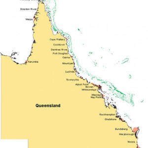
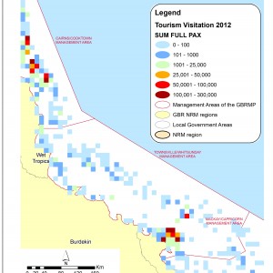
Visited location in the GBR, between Townsville and Whitsunday

Map of popular visited touristic location in the Great Barrier Reef (GBR), between Townsville and Whitsunday Management Area.
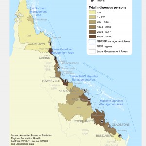
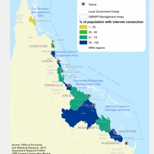
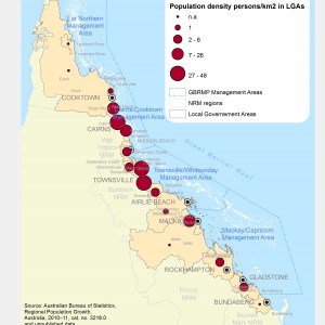
Source: This map incorporates data which is:
© Commonwealth of Australia, Great Barrier Reef Marine Park Authority (GBRMPA) data - Elisabeth Murdoch College (EMC) 2012.
© State of Queensland 2012 data

CC BY by SELTMP

GBR Foundation Logo

Centre for Sustainable Tropical Fisheries & Aquaculture (CSTFA)

Department of the Environment

CSIRO Logo

JCU Logo

GBRMPA Logo

RRRC Logo (stacked)

Login