

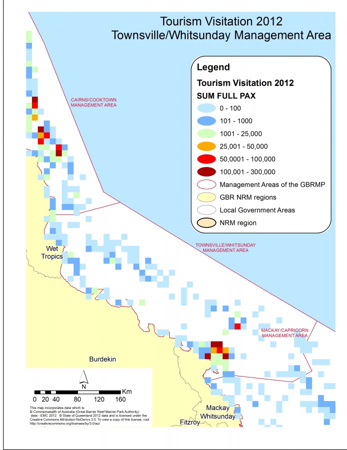
Visited location in the GBR, between Townsville and Whitsunday
Photographers: Petina Pert
Description
Map of popular visited touristic location in the Great Barrier Reef (GBR), between Townsville and Whitsunday Management Area.
Source: This map incorporates data which is:
© Commonwealth of Australia, Great Barrier Reef Marine Park Authority (GBRMPA) data - Elisabeth Murdoch College (EMC) 2012.
© State of Queensland 2012 data
Image produced for the project
Photo galleries
File usage
Gallery